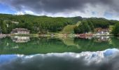
![](/images/other/stat-length.png)
![Trail On foot Sillano Giuncugnano - Cerreto dell'Alpi - La Gabellina - Lago Pranda - Cerreto Laghi - Passo di Belfiore - Photo](https://media.geolcdn.com/t/1900/400/376c7915-2c12-4747-9a45-335e4fc4fcc5.jpeg&format=pjpeg&maxdim=2)
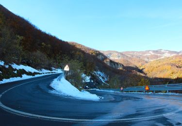
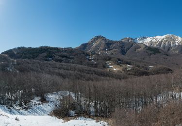
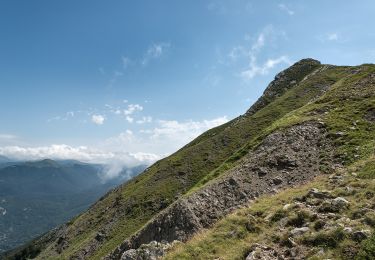
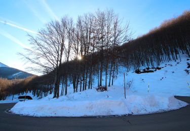
Cerreto dell'Alpi - La Gabellina - Lago Pranda - Cerreto Laghi - Passo di Belfiore
SityTrail - itinéraires balisés pédestres
Tous les sentiers balisés d’Europe GUIDE+
![Length](/images/other/stat-length.png)
Length
10.2 km
![Max alt](https://static1.geolcdn.com/siteimages/upload/files/1508320355ic_sort_altitude_max_24dp.png)
Max alt
1662 m
![Uphill gradient](https://static1.geolcdn.com/siteimages/upload/files/1508320355ic_sort_den_pos_24dp.png)
Uphill gradient
104 m
![Km-Effort](/images/other/stat-length.png)
Km-Effort
14 km
![Min alt](https://static1.geolcdn.com/siteimages/upload/files/1508320355ic_sort_altitude_min_24dp.png)
Min alt
913 m
![Downhill gradient](https://static1.geolcdn.com/siteimages/upload/files/1508320355ic_sort_den_neg_24dp.png)
Downhill gradient
846 m
![Boucle](https://static1.geolcdn.com/siteimages/upload/files/16400158638029165_repeat_loop_refresh_sync_direction_icon.png)
Boucle
No
Signpost
Creation date :
2022-02-15 06:03:02.863
Updated on :
2022-03-01 04:27:59.079
![On foot](https://static1.geolcdn.com/sitytour/trail-icons/100.png)
3h11
Difficulty : Easy
![Scan this QR Code to open this trail in the SityTrail application](https://capi.geolives.com/qq0zvz2zws4bq2lad0pu/sitytour/trails/3116252/qr.png?size=200)
FREE GPS app for hiking
About
Trail On foot of 10.2 km to be discovered at Tuscany, Lucca, Sillano Giuncugnano. This trail is proposed by SityTrail - itinéraires balisés pédestres.
Description
Trail created by CAI Castelnovo Ne' Monti.
Symbol: 649 on white red flags
Positioning
Country:
Italy
Region :
Tuscany
Department/Province :
Lucca
Municipality :
Sillano Giuncugnano
Location:
Unknown
Start:(Dec)
Start:(UTM)
600601 ; 4902590 (32T) N.
Comments
Trails nearby
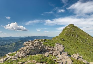
![Trail On foot Fivizzano - (SI L20) Passo del Cerreto - Rifugio Sarzana al Monte Acuto - Photo](https://media.geolcdn.com/t/375/260/517caf56-276f-40c9-a884-2c512ca00215.jpeg&format=jpg&maxdim=2)
![On foot On foot](https://static1.geolcdn.com/sitytour/trail-icons/100.png)
(SI L20) Passo del Cerreto - Rifugio Sarzana al Monte Acuto
On foot
Easy
Fivizzano,
Tuscany,
Massa-Carrara,
Italy
![](/images/other/stat-length.png)
8.1 km | 17 km-effort
3h 52min
![](https://static1.geolcdn.com/siteimages/upload/files/16400158638029165_repeat_loop_refresh_sync_direction_icon.png)
No
![Trail On foot Fivizzano - Pratizzano - Collagna - Cerreto Alpi - Lago Pranda - Passo Crocetta - Photo](https://media.geolcdn.com/t/375/260/05af87f4-bd42-46e4-be0b-3613e20411be.jpeg&format=jpg&maxdim=2)
![On foot On foot](https://static1.geolcdn.com/sitytour/trail-icons/100.png)
Pratizzano - Collagna - Cerreto Alpi - Lago Pranda - Passo Crocetta
On foot
Medium
Fivizzano,
Tuscany,
Massa-Carrara,
Italy
![](/images/other/stat-length.png)
14.4 km | 24 km-effort
5h 29min
![](https://static1.geolcdn.com/siteimages/upload/files/16400158638029165_repeat_loop_refresh_sync_direction_icon.png)
No
![Trail On foot Fivizzano - (SI L20OLD) Passo del Cerreto - Rifugio Sarzana al Monte Acuto - Diga del Lagastrello - Pratospilla - Photo](https://media.geolcdn.com/t/375/260/62540591-420b-4e4d-8416-7c39d58c5ec8.jpeg&format=jpg&maxdim=2)
![On foot On foot](https://static1.geolcdn.com/sitytour/trail-icons/100.png)
(SI L20OLD) Passo del Cerreto - Rifugio Sarzana al Monte Acuto - Diga del Lag...
On foot
Medium
Fivizzano,
Tuscany,
Massa-Carrara,
Italy
![](/images/other/stat-length.png)
15.6 km | 30 km-effort
6h 52min
![](https://static1.geolcdn.com/siteimages/upload/files/16400158638029165_repeat_loop_refresh_sync_direction_icon.png)
No
![Trail On foot Ventasso - (SI L19) Passo di Pradarena - Passo del Cerreto - Photo](https://media.geolcdn.com/t/375/260/05af87f4-bd42-46e4-be0b-3613e20411be.jpeg&format=jpg&maxdim=2)
![On foot On foot](https://static1.geolcdn.com/sitytour/trail-icons/100.png)
(SI L19) Passo di Pradarena - Passo del Cerreto
On foot
Easy
Ventasso,
Emilia-Romagna,
Reggio nell'Emilia,
Italy
![](/images/other/stat-length.png)
10.7 km | 18.3 km-effort
4h 9min
![](https://static1.geolcdn.com/siteimages/upload/files/16400158638029165_repeat_loop_refresh_sync_direction_icon.png)
No
![Trail On foot Fivizzano - IT-94 - Photo](https://media.geolcdn.com/t/375/260/eeef3f13-f531-4d78-8a82-ae0e94ddaa2e.jpeg&format=jpg&maxdim=2)
![On foot On foot](https://static1.geolcdn.com/sitytour/trail-icons/100.png)
![Trail On foot Ventasso - La Gabellina - Sorgenti del Secchia - Sella di Monte Casarola - Rifugio Rio Pascolo - Photo](https://media.geolcdn.com/t/375/260/29de0cc0-a9bb-44da-9888-67b7bb103c86.jpeg&format=jpg&maxdim=2)
![On foot On foot](https://static1.geolcdn.com/sitytour/trail-icons/100.png)
La Gabellina - Sorgenti del Secchia - Sella di Monte Casarola - Rifugio Rio P...
On foot
Easy
Ventasso,
Emilia-Romagna,
Reggio nell'Emilia,
Italy
![](/images/other/stat-length.png)
8 km | 18.4 km-effort
4h 10min
![](https://static1.geolcdn.com/siteimages/upload/files/16400158638029165_repeat_loop_refresh_sync_direction_icon.png)
No
![Trail On foot Fivizzano - Passo Dell'ospedalaccio - Sorgenti del Secchia - Passo di Pietratagliata - Alpe di Succiso - Photo](https://media.geolcdn.com/t/375/260/8e86ac16-9816-4d6e-ac93-aebd63dc1989.jpeg&format=jpg&maxdim=2)
![On foot On foot](https://static1.geolcdn.com/sitytour/trail-icons/100.png)
Passo Dell'ospedalaccio - Sorgenti del Secchia - Passo di Pietratagliata - Al...
On foot
Easy
Fivizzano,
Tuscany,
Massa-Carrara,
Italy
![](/images/other/stat-length.png)
4 km | 11.6 km-effort
2h 38min
![](https://static1.geolcdn.com/siteimages/upload/files/16400158638029165_repeat_loop_refresh_sync_direction_icon.png)
No
![Trail On foot Fivizzano - IT-100 - Photo](https://media.geolcdn.com/t/375/260/9298b27a-d21d-4081-ae51-5634855d6843.jpeg&format=jpg&maxdim=2)
![On foot On foot](https://static1.geolcdn.com/sitytour/trail-icons/100.png)
![Trail On foot Ventasso - IT-643 - Photo](https://media.geolcdn.com/t/375/260/e9e02c55-b877-44f1-887d-3f1ad69c22cd.jpeg&format=jpg&maxdim=2)
![On foot On foot](https://static1.geolcdn.com/sitytour/trail-icons/100.png)
IT-643
On foot
Easy
Ventasso,
Emilia-Romagna,
Reggio nell'Emilia,
Italy
![](/images/other/stat-length.png)
6.3 km | 12.1 km-effort
2h 44min
![](https://static1.geolcdn.com/siteimages/upload/files/16400158638029165_repeat_loop_refresh_sync_direction_icon.png)
No